File:SkywalkTopo.jpg
From HighestBridges.com
Jump to navigationJump to search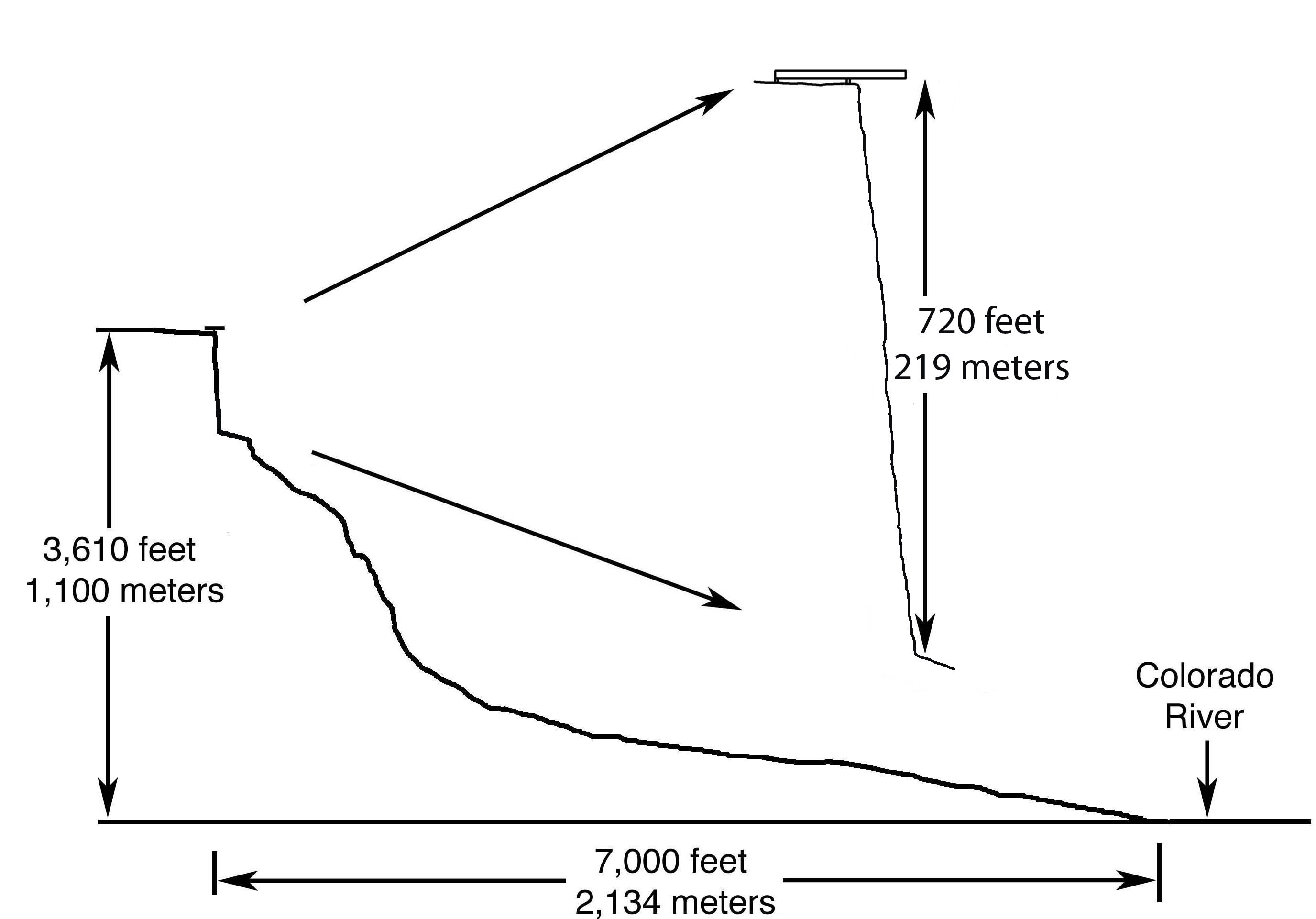
Size of this preview: 800 × 559 pixels. Other resolutions: 320 × 223 pixels | 2,752 × 1,922 pixels.
Original file (2,752 × 1,922 pixels, file size: 262 KB, MIME type: image/jpeg)
Grand Canyon Skywalk elevation by Eric Sakowski based on measurements and USGS topo maps.
File history
Click on a date/time to view the file as it appeared at that time.
| Date/Time | Thumbnail | Dimensions | User | Comment | |
|---|---|---|---|---|---|
| current | 05:14, 24 September 2010 | | 2,752 × 1,922 (262 KB) | Sakowski (talk | contribs) | Grand Canyon Skywalk elevation by Eric Sakowski based on laser rangefinder measurements from the Skywalk Deck and USGS topo maps. |
You cannot overwrite this file.
File usage
The following page uses this file: