Difference between revisions of "Horganal Bridge"
| Line 6: | Line 6: | ||
361 foot span / 110 meter span<br /> | 361 foot span / 110 meter span<br /> | ||
2013<br /> | 2013<br /> | ||
| − | [[File: | + | [[File:Puente HorganalKm53 orKm670.jpg|750px|center]] |
</div> | </div> | ||
| Line 30: | Line 30: | ||
| − | [[File: | + | [[File:Puente Horganal Autopista Mitla-Tehuantepec Hwy.jpg|750px|center]] |
| − | [[File: | + | [[File:Puente Horganal Autopista Mitla-Tehuantepec.jpg|750px|center]] |
| − | [[File: | + | [[File:HorganalBridgeLocationMap.jpg|450px|center]] |
| − | [[File: | + | [[File:MITLA – ENTRONQUE TEHUANTEPEC II Map.jpg|450px|center]] |
| − | + | Route of the Mitla-Tehuantepec highway. | |
| − | |||
| − | |||
| − | |||
| − | |||
| − | |||
| − | |||
| − | |||
| − | |||
| − | |||
| − | |||
| − | |||
| − | |||
| − | |||
| − | |||
| − | |||
| − | |||
| − | |||
| − | |||
| − | |||
| − | |||
| − | |||
| − | |||
| − | |||
| − | |||
| − | |||
| − | |||
| − | |||
| − | |||
| − | |||
| − | |||
| − | |||
| − | |||
| − | |||
| − | |||
| − | |||
| − | |||
| − | |||
| − | |||
| − | |||
| − | |||
| − | |||
| − | |||
| − | |||
| − | |||
| − | |||
| − | |||
| − | |||
| − | |||
| − | |||
| − | |||
| − | |||
| − | |||
| − | |||
| − | |||
| − | |||
| − | |||
| − | |||
| − | |||
| − | |||
| − | |||
| − | |||
| − | |||
[[Category:Bridges in Mexico]] | [[Category:Bridges in Mexico]] | ||
[[Category:Bridges in Durango, Mexico]] | [[Category:Bridges in Durango, Mexico]] | ||
Revision as of 05:51, 4 April 2013
Horganal Bridge
Puente Horganal
San Bartolo Albarradas, Oaxaca, Mexico
(394) feet high / (120) meters high
361 foot span / 110 meter span
2013
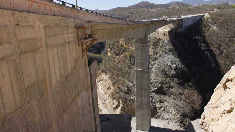
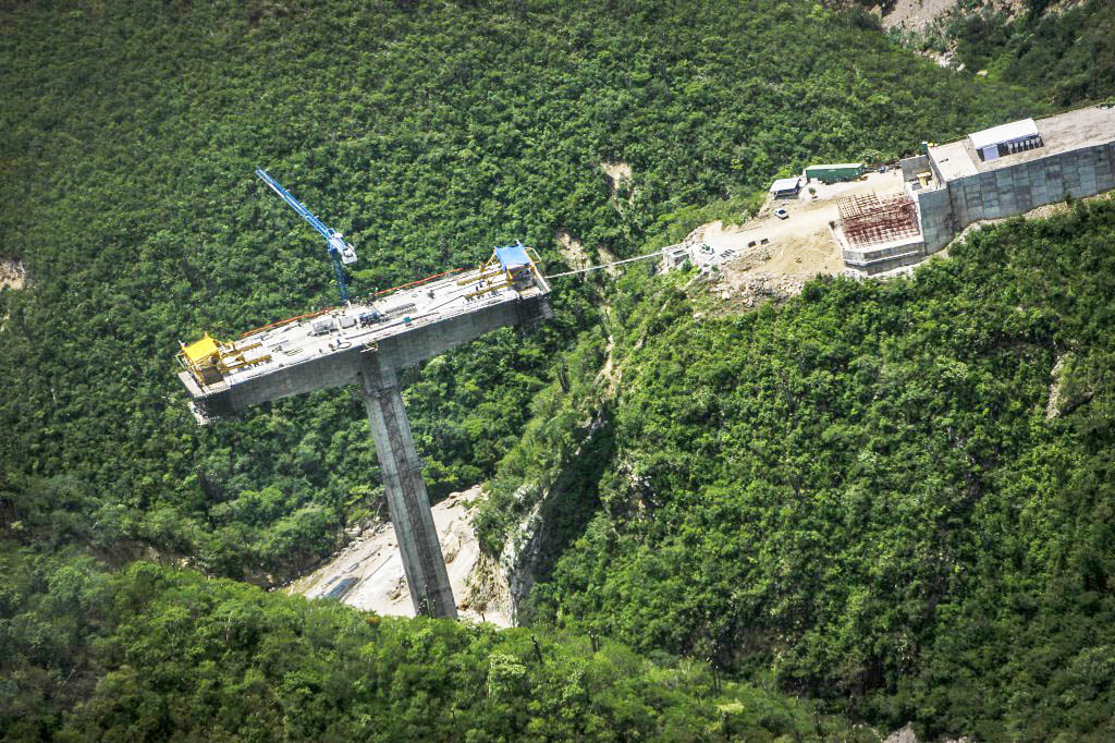
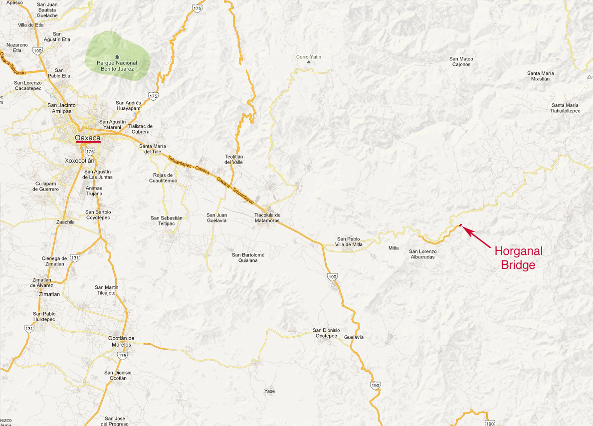
Horganal Bridge is the first of what will eventually be more then 60 bridges along the new Mitla-Tehuantepec highway that will eventually connect Oaxaca city with the coastal city of Salina Cruz on the Pacific Ocean.
Given the difficulties inherent in building the highway through such rugged and mountainous terrain, the highway will probably not be completed for at least 4 more years. In addition to Horganal, the route will also cross the Aguascalientes River on the towering Lachiguiri Bridge which will also be completed in 2013 on the southern end of the highway even if the entire central section will not be completed till at least 2016. The 3 major sections of the highway will include:
1) Mitla-Santa Maria Albarradas - 28.8 kilometers long.
2) Santa Maria Albarradas-Santiago Lachiguiri - 91.4 kilometers long.
3) Santiago Lachiguiri-Tehuantepec Junction II - 49.0 kilometers long.
Horganal surpassed the El Cimarrón Bridge on the Xalapa Bypass highway in Veracruz as Mexico's tallest single tower beam bridge. El Cimarrón Bridge opened in late 2012. Horganal has a span configuration 2 x 110 meters atop a 91 meter tall pier.
Route of the Mitla-Tehuantepec highway.


