File:ChinaHighBridgeMap.jpg
From HighestBridges.com
Jump to navigationJump to search
Size of this preview: 673 × 600 pixels. Other resolutions: 269 × 240 pixels | 4,254 × 3,792 pixels.
Original file (4,254 × 3,792 pixels, file size: 1.14 MB, MIME type: image/jpeg)
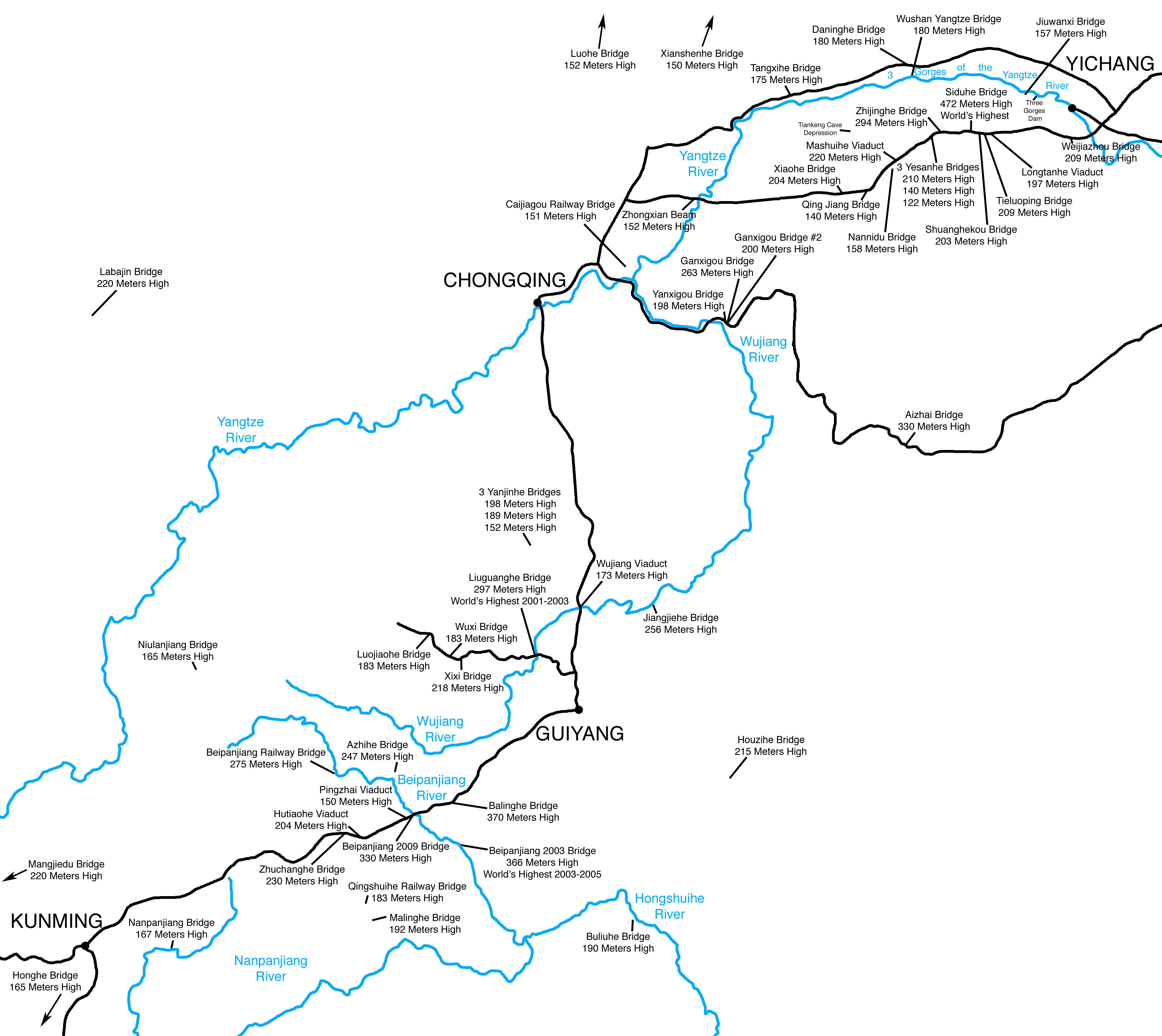
Map of Western China shows approximately 40 of their Highest Bridges. They make up nearly half of the world's 100 highest bridges. By 2020, Western China may have more high bridges than every other country on earth combined!
File history
Click on a date/time to view the file as it appeared at that time.
| Date/Time | Thumbnail | Dimensions | User | Comment | |
|---|---|---|---|---|---|
| current | 07:22, 5 January 2010 | | 4,254 × 3,792 (1.14 MB) | Sakowski (talk | contribs) | China High Bridge Map by Eric Sakowski / HighestBridges.com |
You cannot overwrite this file.
File usage
The following 2 pages use this file: