File:DurangoHwyKm157-180.jpg
From HighestBridges.com
Jump to navigationJump to search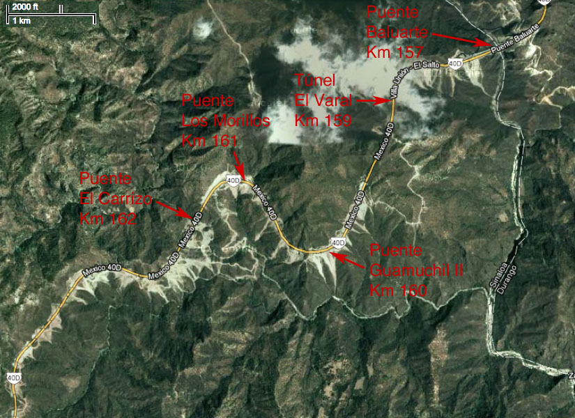
Size of this preview: 800 × 582 pixels. Other resolutions: 320 × 233 pixels | 825 × 600 pixels.
Original file (825 × 600 pixels, file size: 189 KB, MIME type: image/jpeg)
Durango Hwy Km 157-180 map.
File history
Click on a date/time to view the file as it appeared at that time.
| Date/Time | Thumbnail | Dimensions | User | Comment | |
|---|---|---|---|---|---|
| current | 20:20, 13 February 2013 | | 825 × 600 (189 KB) | Sakowski (talk | contribs) | Durango Hwy Km 157-180 map. |
You cannot overwrite this file.
File usage
The following file is a duplicate of this file (more details):
There are no pages that use this file.