File:HochmoselbruckeMap3.jpg
From HighestBridges.com
Jump to navigationJump to search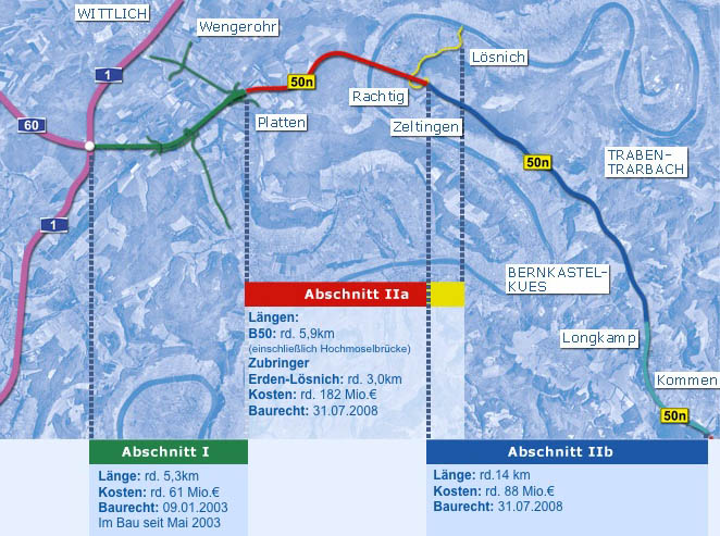
No higher resolution available.
HochmoselbruckeMap3.jpg (662 × 493 pixels, file size: 121 KB, MIME type: image/jpeg)
Hochmoselbrucke Area Map.
File history
Click on a date/time to view the file as it appeared at that time.
| Date/Time | Thumbnail | Dimensions | User | Comment | |
|---|---|---|---|---|---|
| current | 18:21, 20 November 2009 | | 662 × 493 (121 KB) | Sakowski (talk | contribs) | Hochmoselbrucke Area Map. |
You cannot overwrite this file.
File usage
There are no pages that use this file.