Pit River Bridge
Pit River Bridge
Veterans of Foreign Wars Memorial Bridge
Shasta Lake, California, United States
500 feet high / 152 meters high
630 foot span / 192 meter span
1942
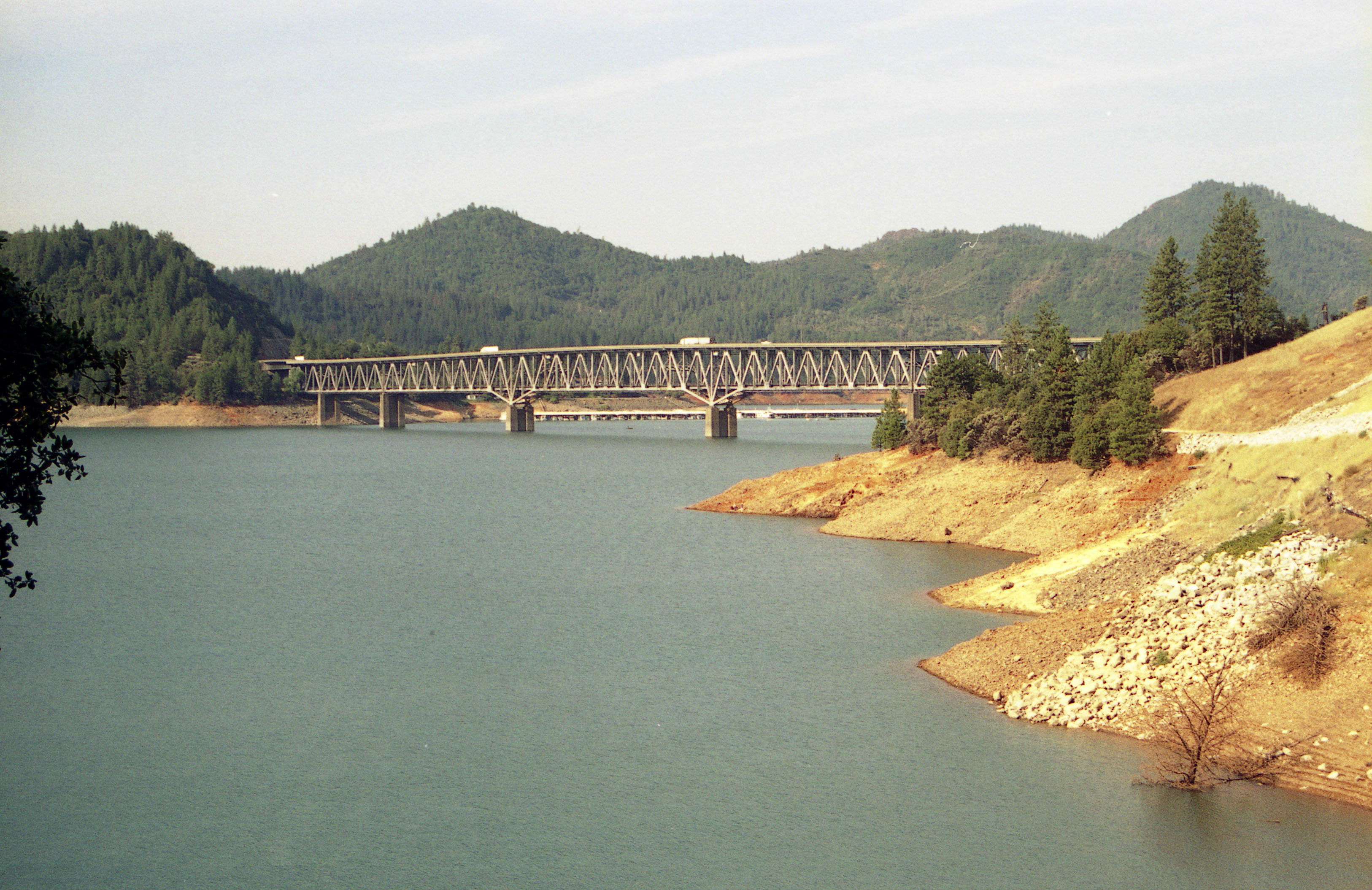
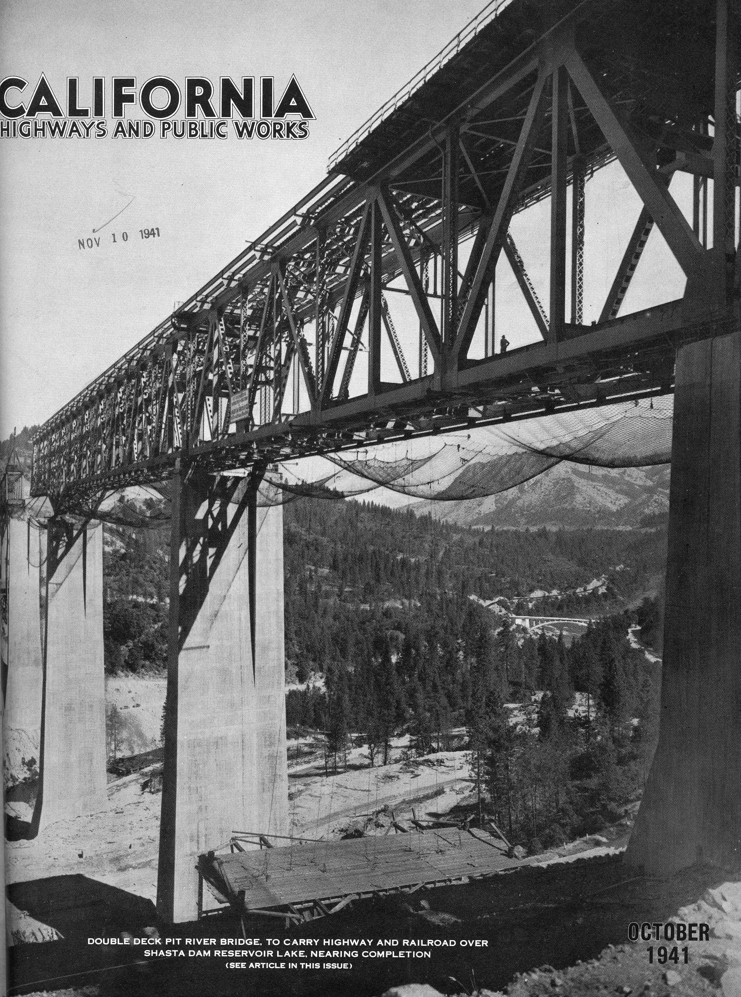
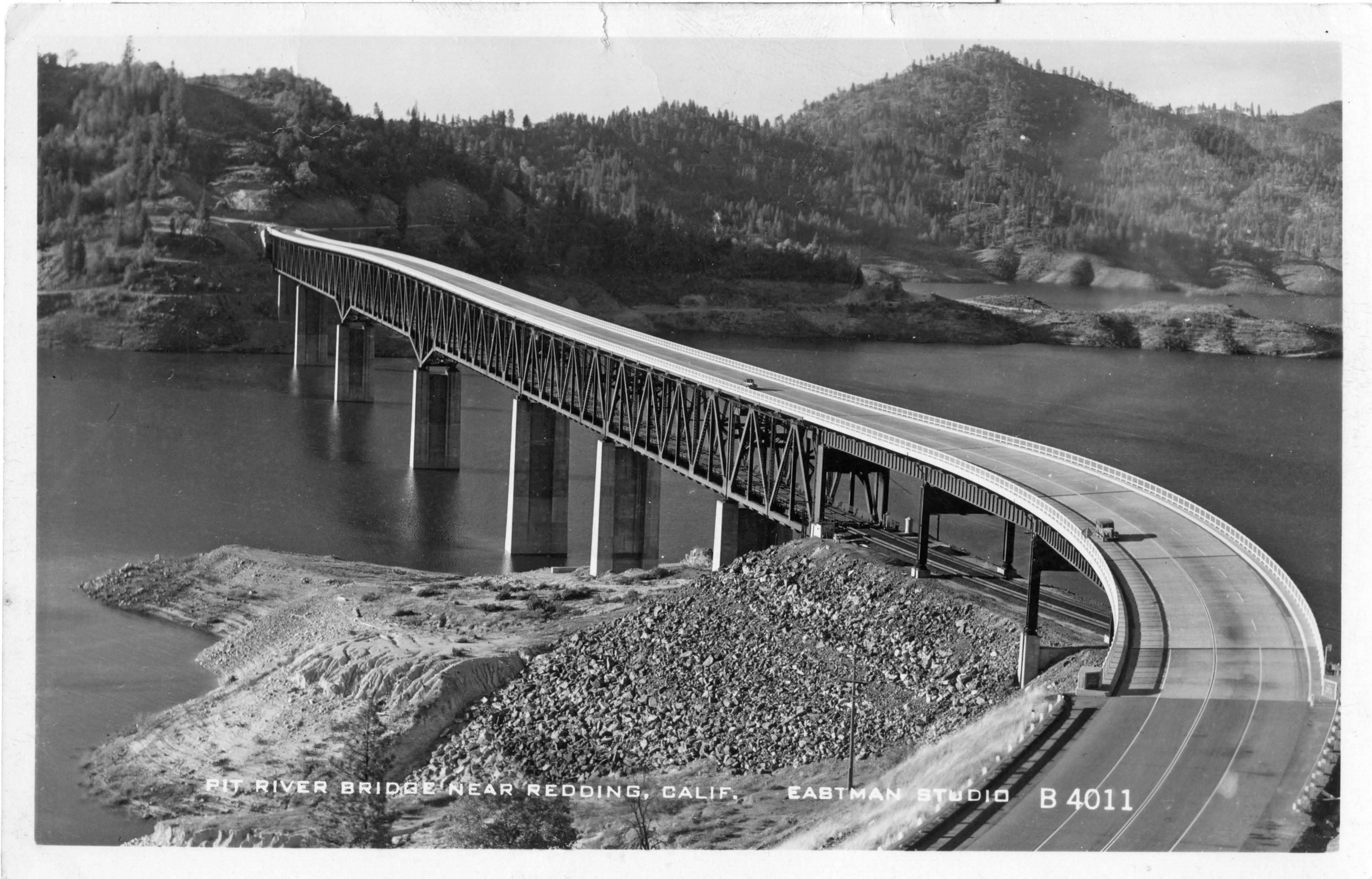
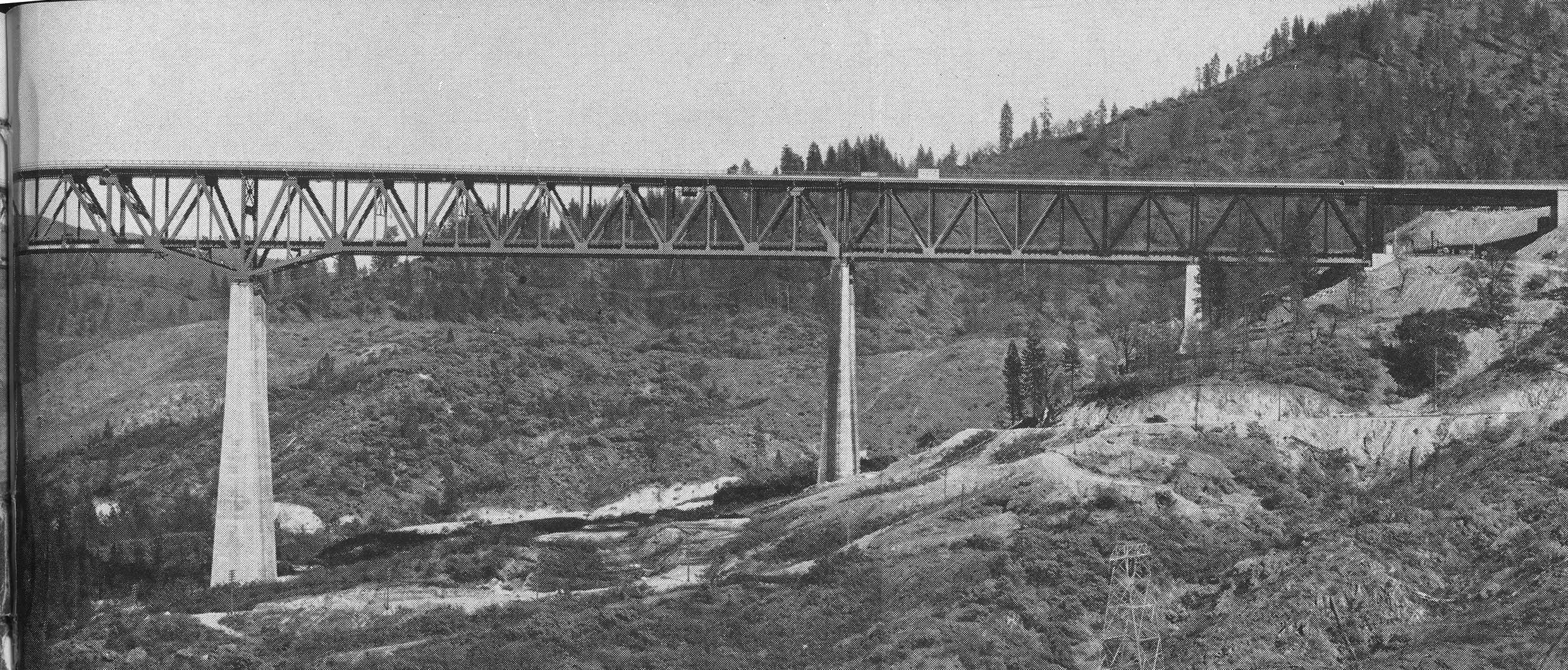
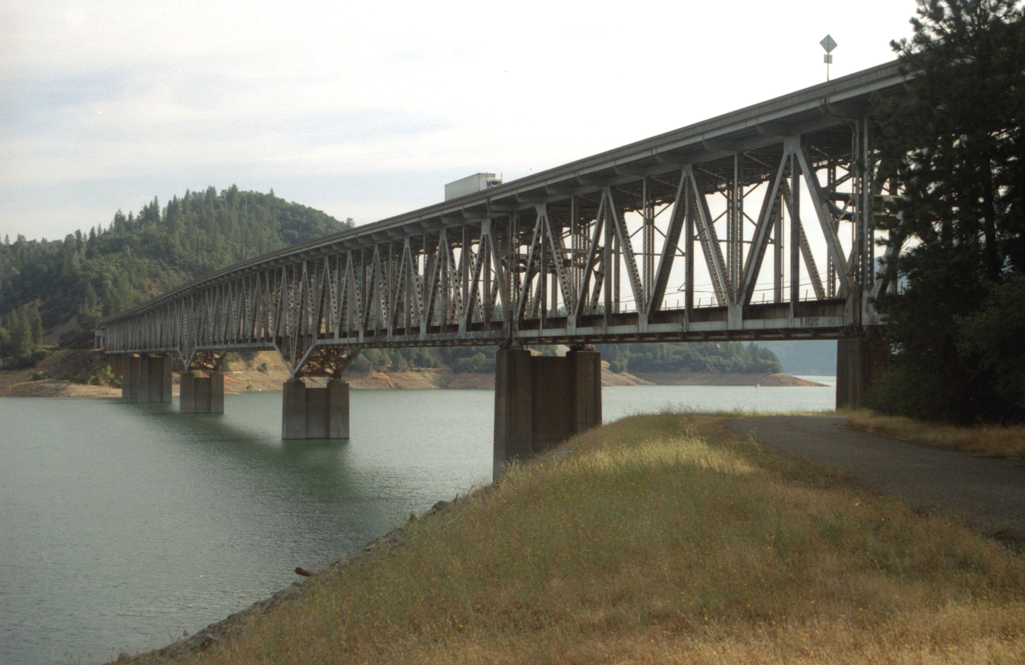
The highest combination road and rail bridge in the world, the Pit River bridge is also the highest rail bridge ever built in the United States. Constructed in 1942, the colossal cantilever bridge was a necessary component of the Southern Pacific railroad relocation from the construction of the 602 foot (183 mtr) high Shasta Dam. The creation of Lake Shasta resulted in a dozen new rail tunnels and 4 towering trestles.
One of the highest concrete dams in the United States, the 602 foot (183 mtr) high Shasta Dam was constructed just downstream of the confluence of the Sacramento and Pit rivers. Extensive surveys were made prior to the dam’s completion to find the most suitable spot for the rail line to cross the deep canyon of the Pit River. The abutments had to be founded on soil that was not prone to landslides once the steep slopes became saturated with water. A route that would have closely followed the nearby McCloud river was changed for just that reason. The final route required large bridges across several major creeks including O’Brien, Doney and Salt in addition to the two big river crossings of the Pit and Sacramento.
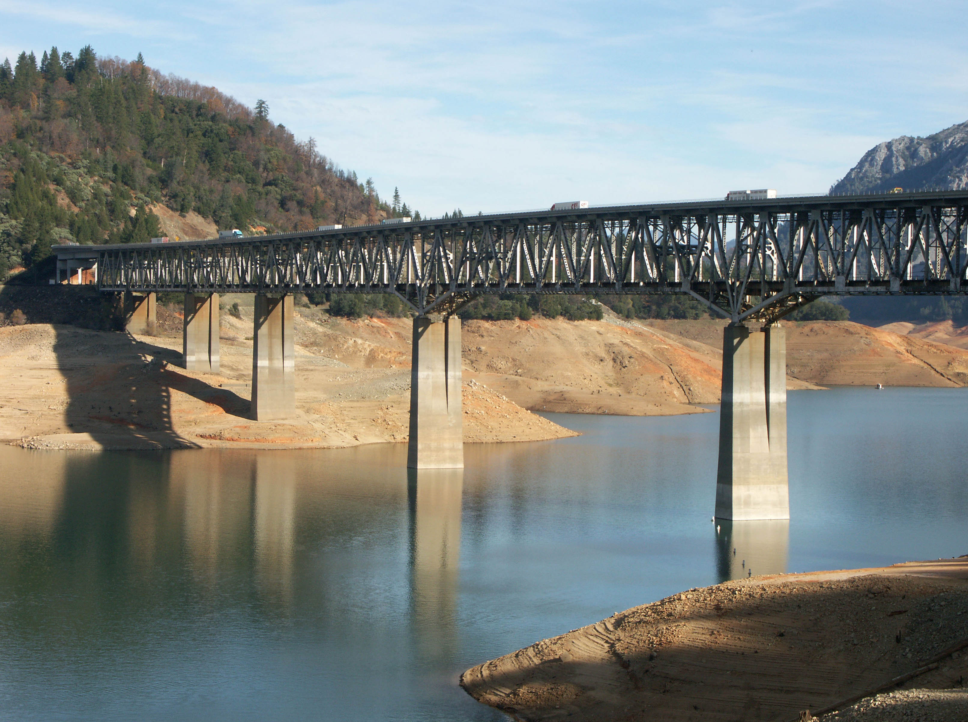
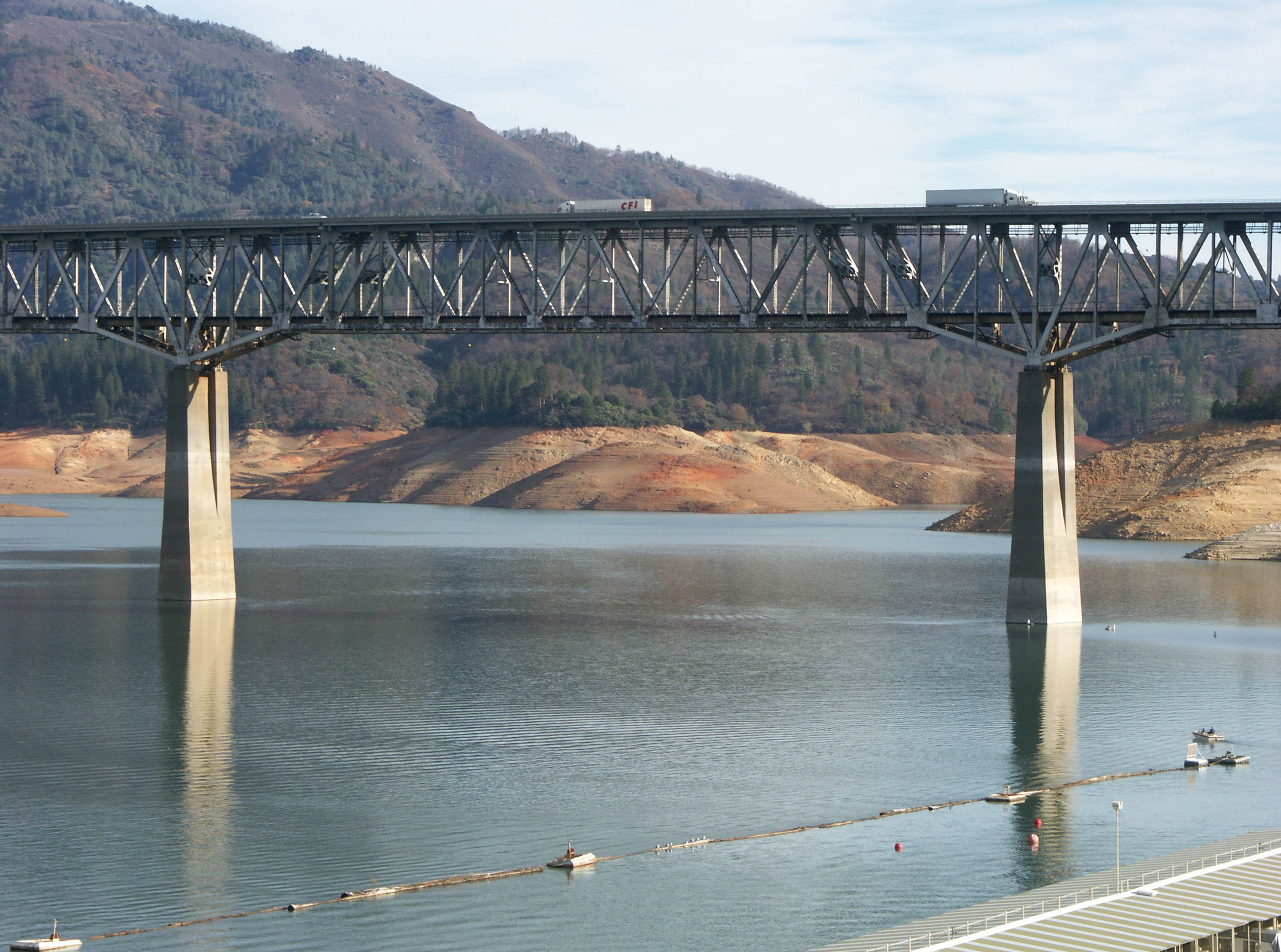
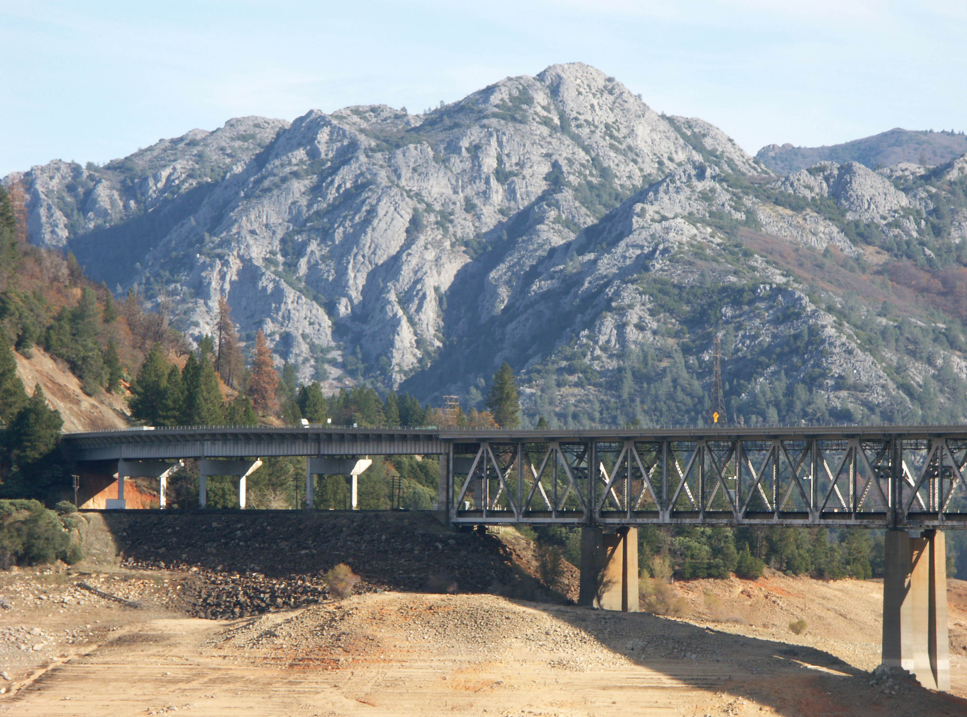
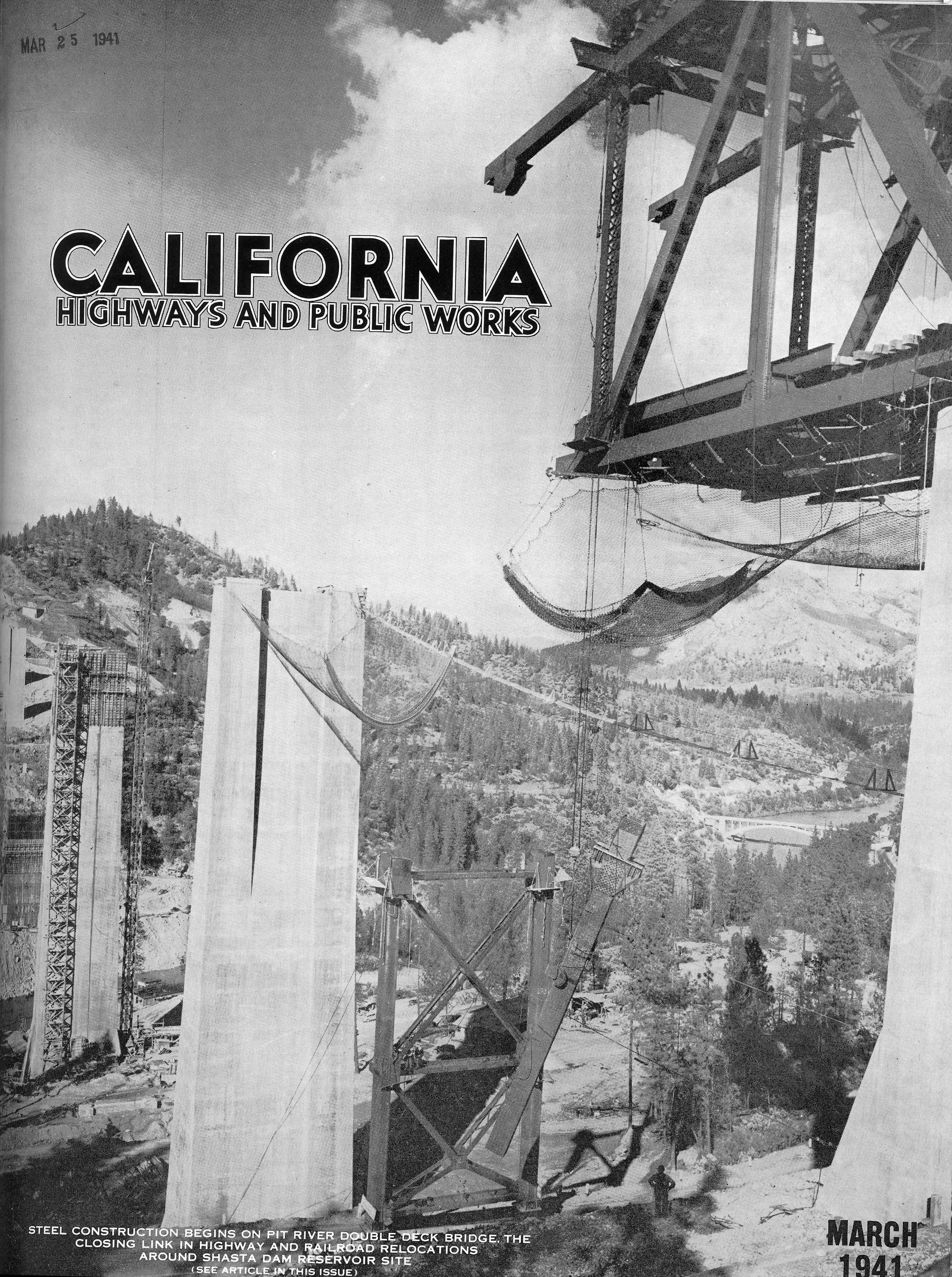
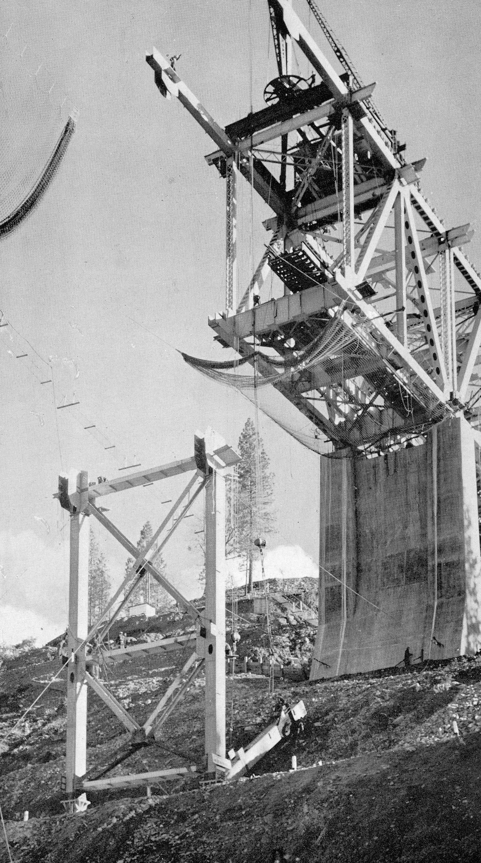
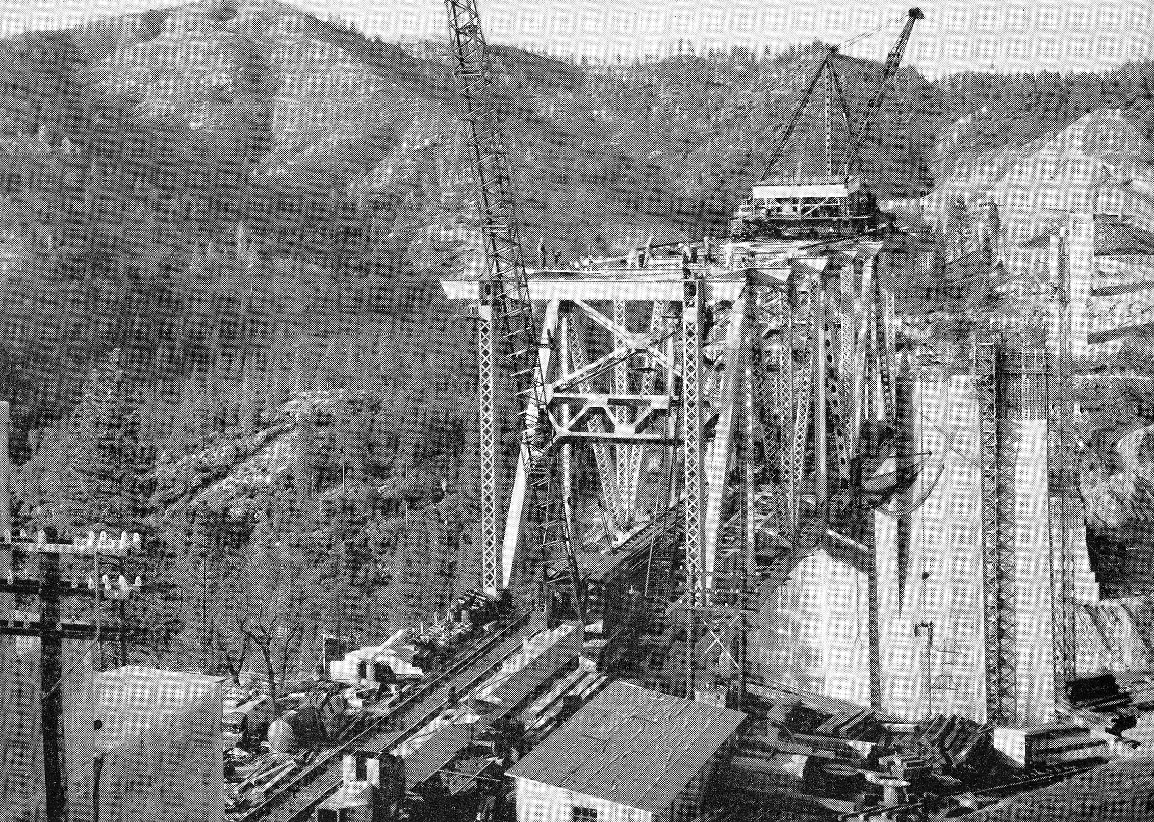
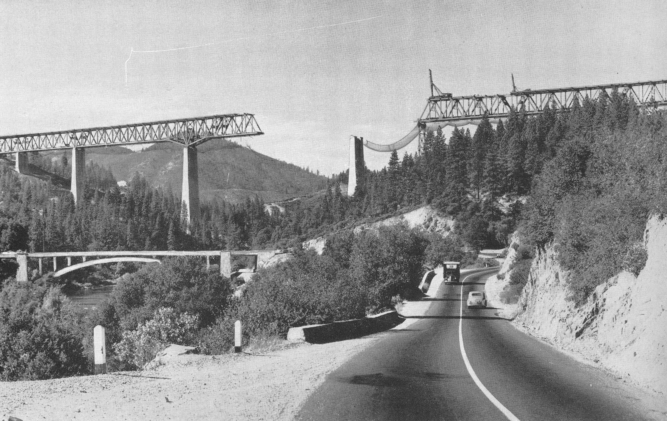
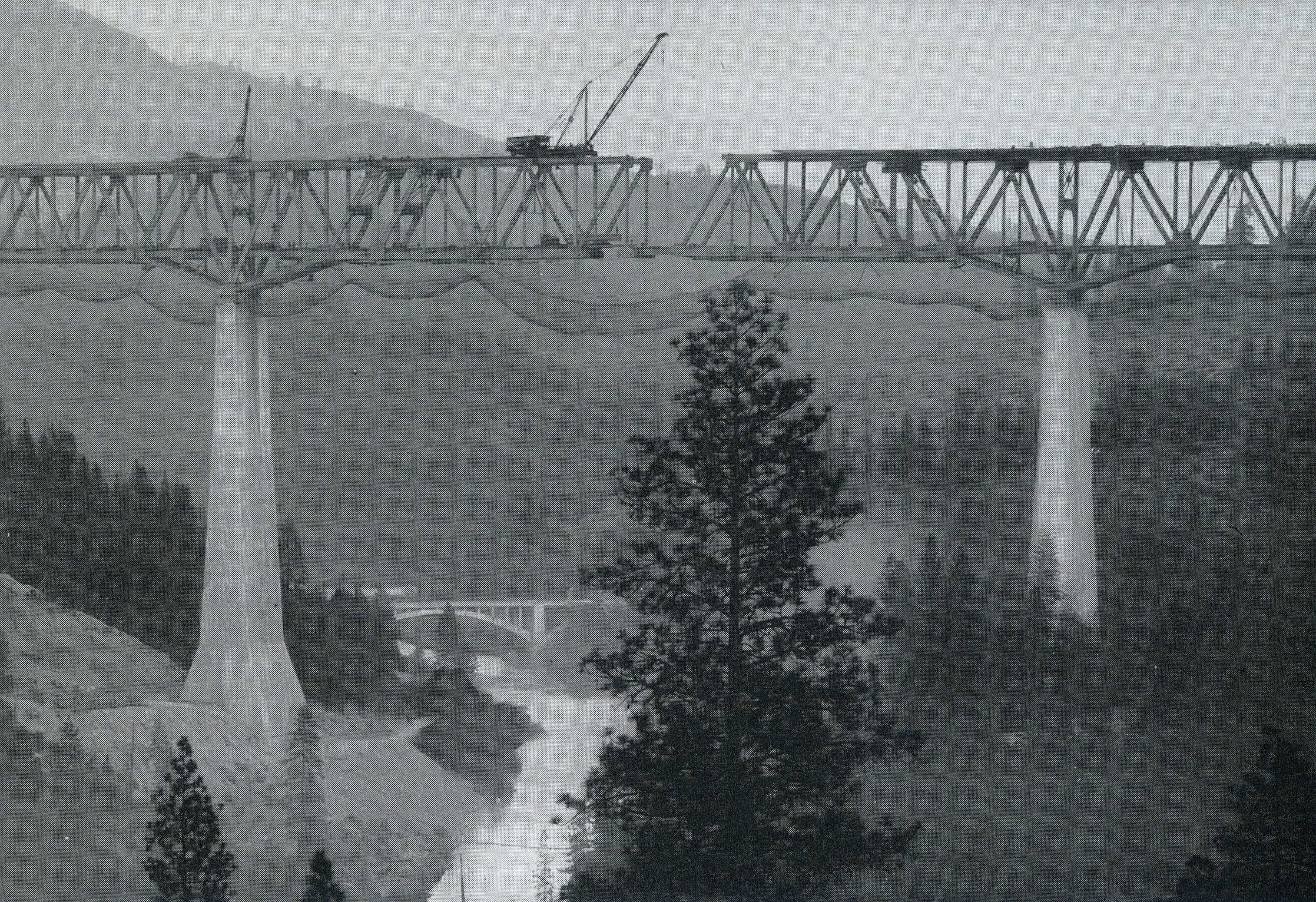
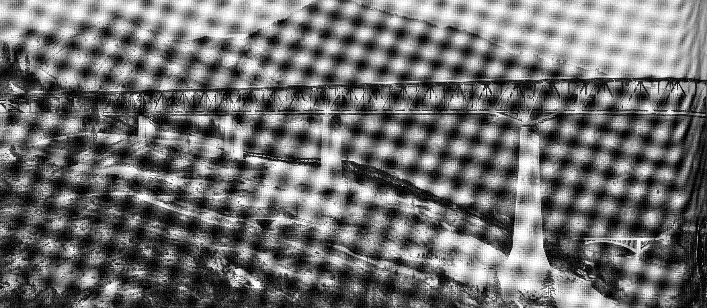
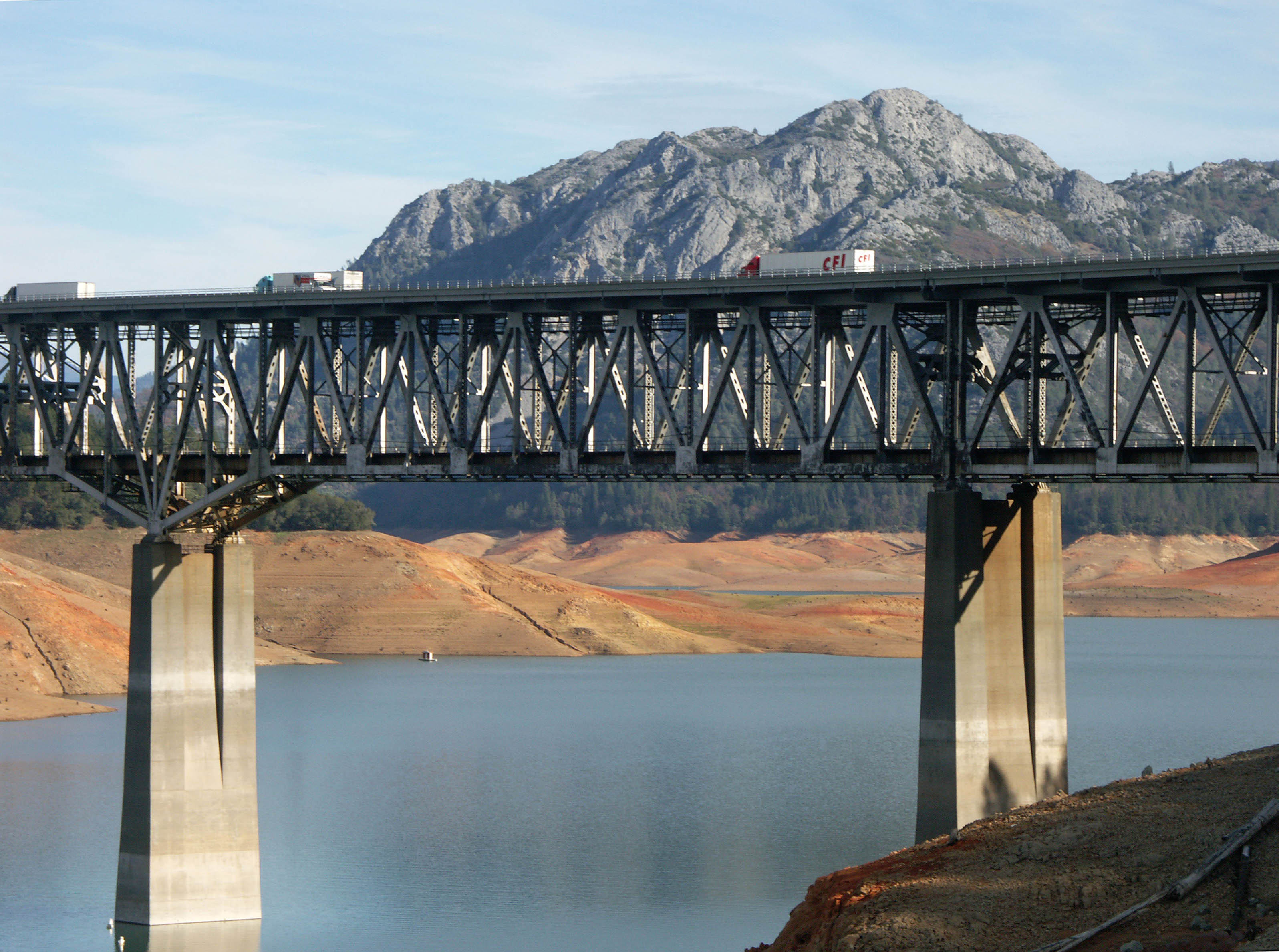
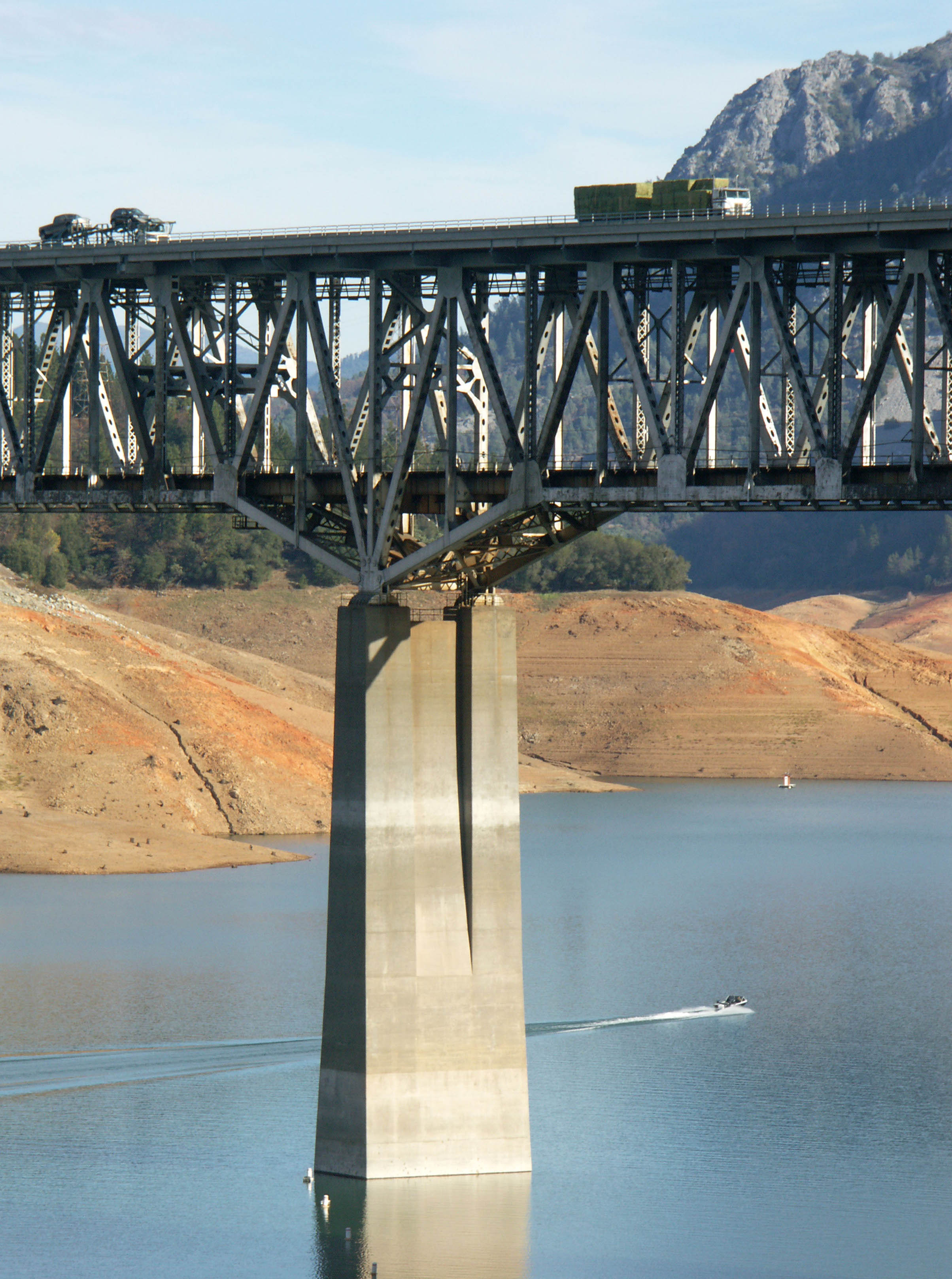
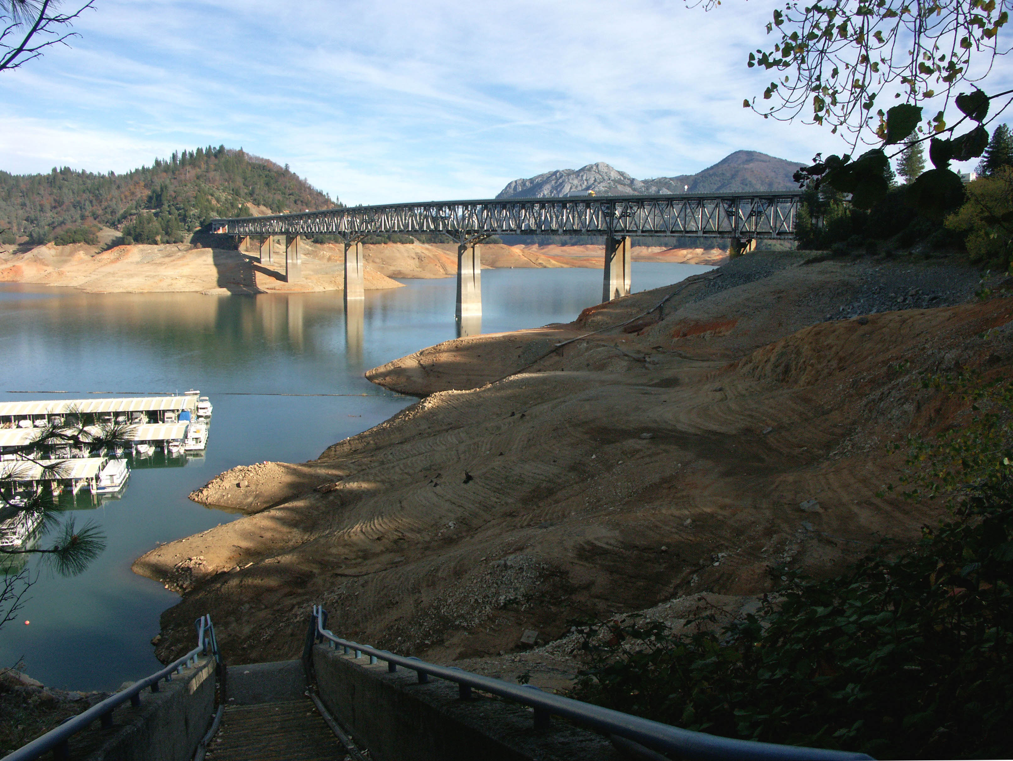
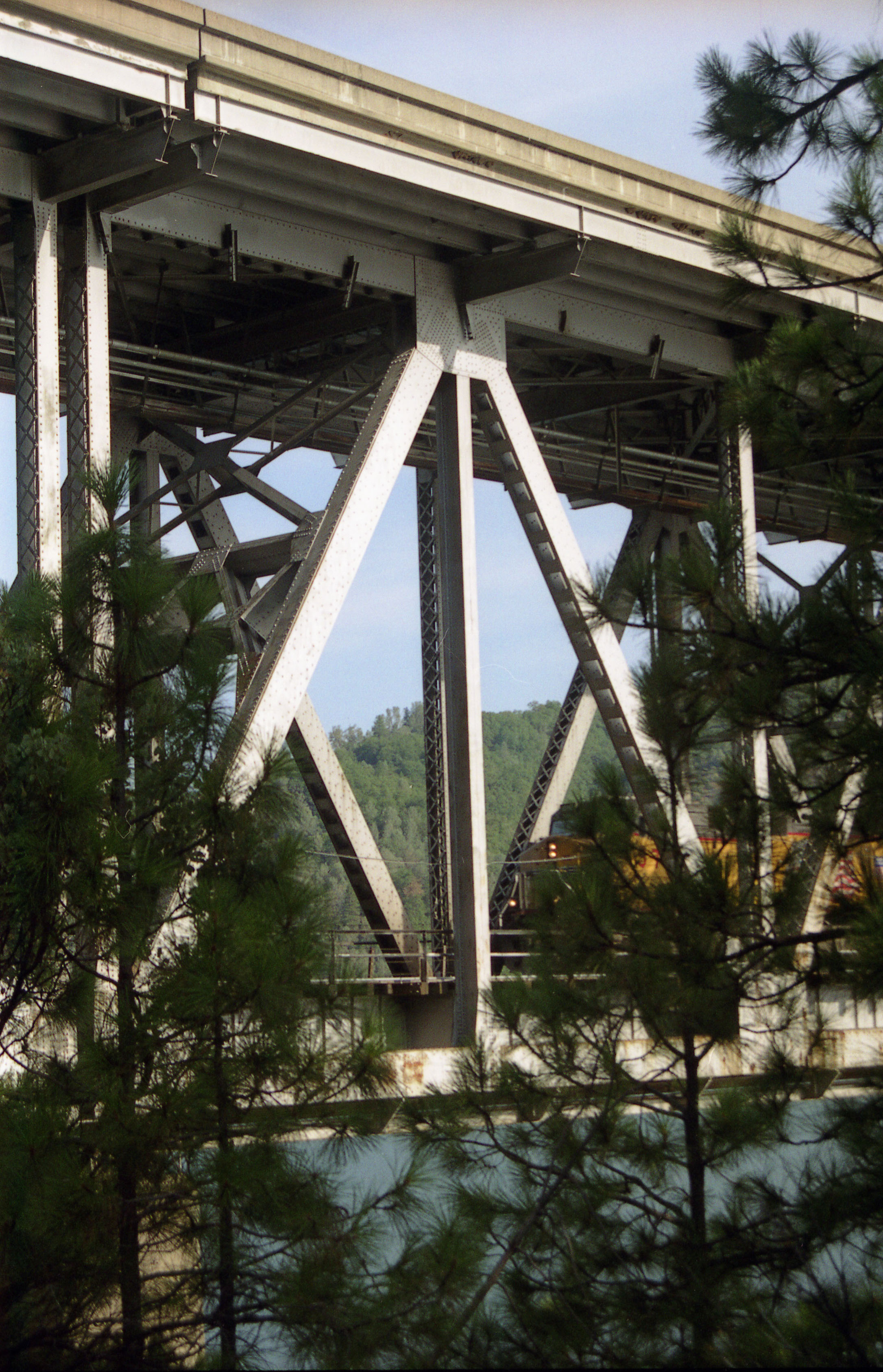
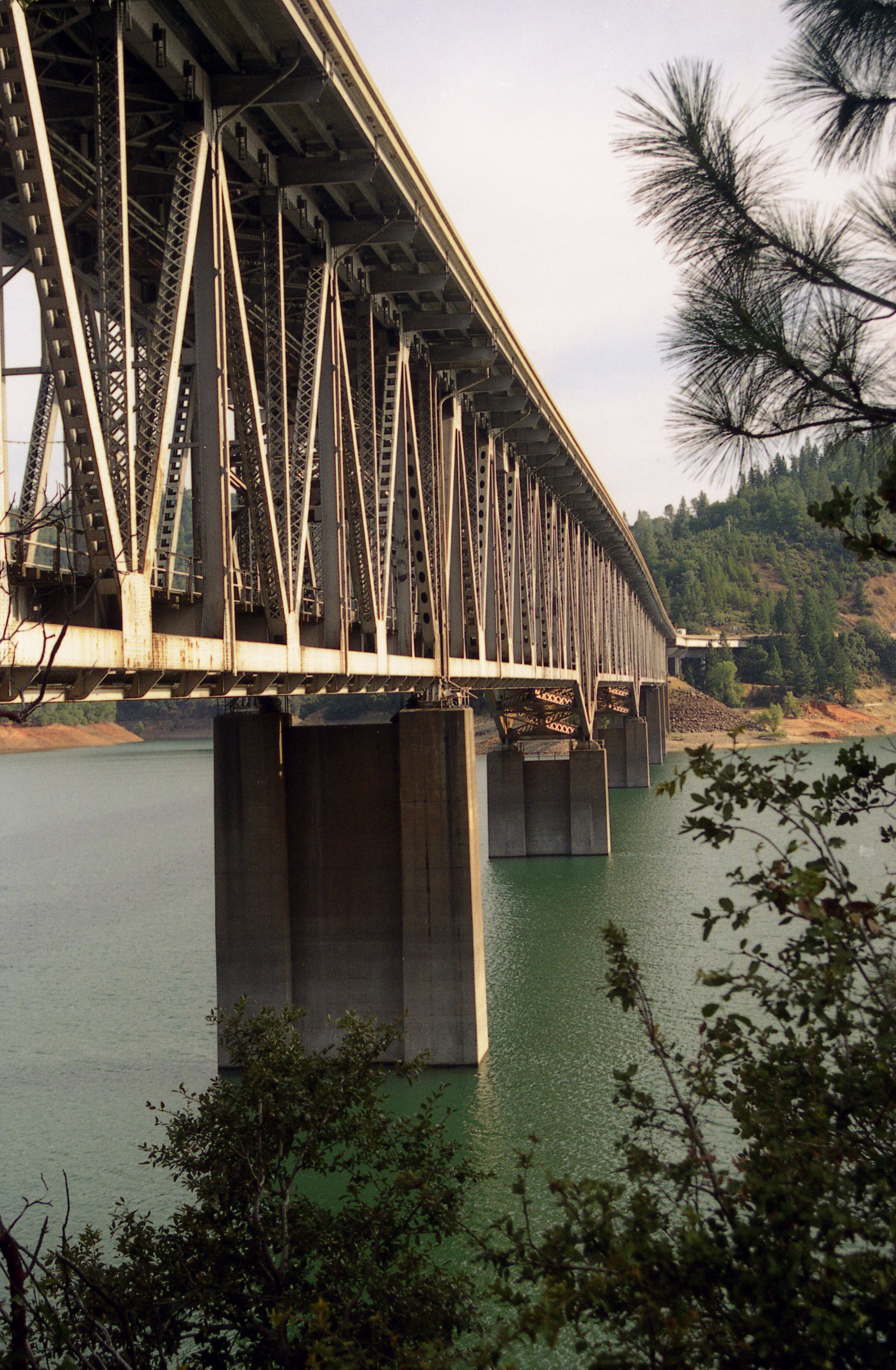
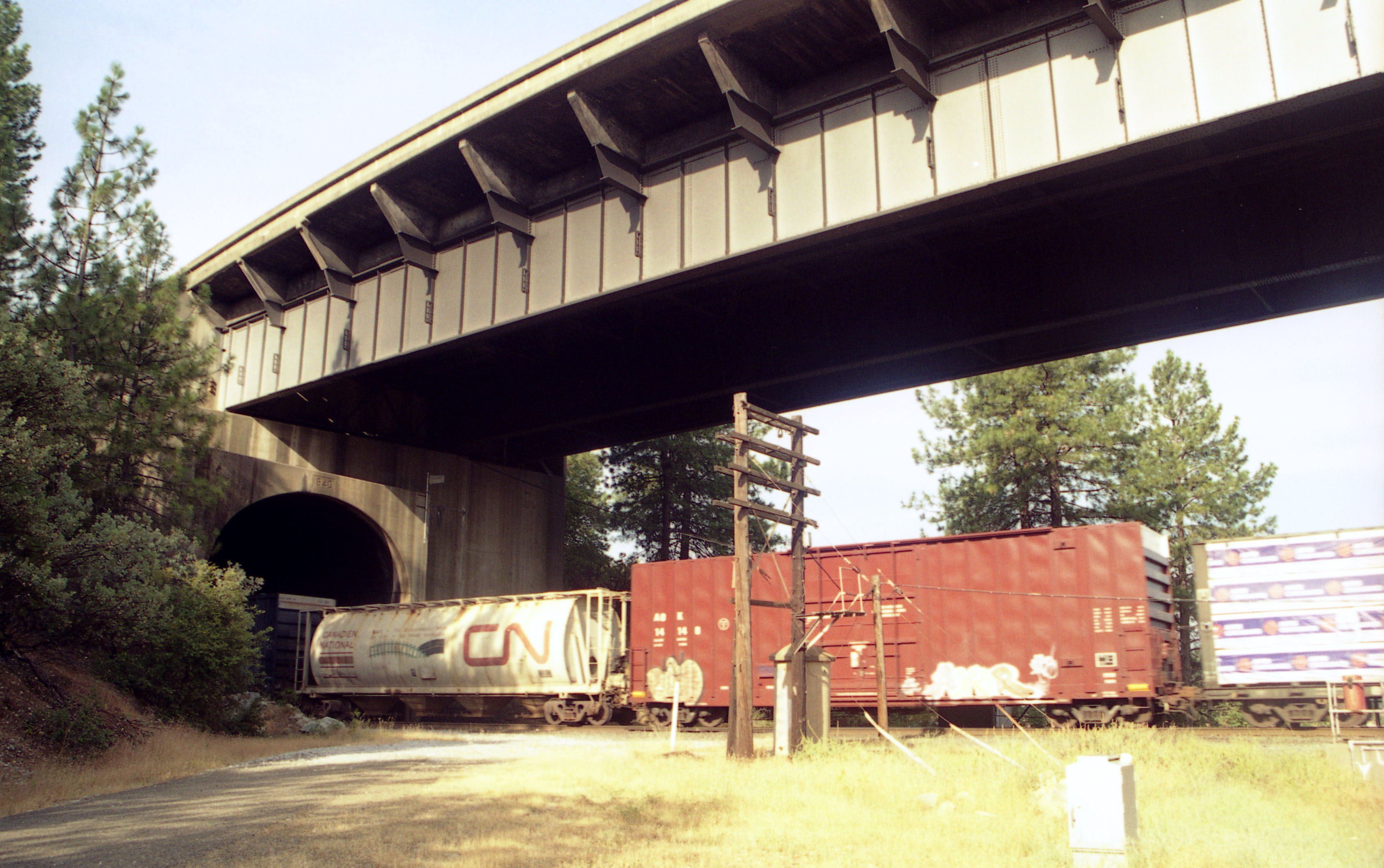
The double deck structure measures 3,588 feet (1,094 mtrs) along the top road deck and 2,754 feet (839 mtrs) along the rail line below. The large central span of 630 feet (192 mtrs) is supported on two massive piers that tower approximately 358 feet (109 mts) from foundation to cap. The base of one of these piers is 95 feet (29 meters) square. To construct the steel bridge, material was loaded onto railroad cars and shipped through the tunnel to the south side of the bridge and out onto the extending structure where a traveler on the top chord would then pick up the pieces from below. To assist in the construction of the trusses, towering temporary bents as high as 275 feet (84 mtrs) were located between the piers. Once the south half of the bridge was completed, the equipment was moved across the river and then the north half was finished. Between 2006 and 2008 the entire road deck was replaced.
Since many will argue that the height of a bridge should be measured to the normal level of the water below it, the honor of America’s highest railway bridge might be more applicable to either the 365 foot (111 mtr) High Steel bridge over the South Fork of the Skokomish river that once served the Simpson Logging company near Shelton, Washington but was converted to road use in 1950 or the 347 foot (106 mtr) high Vance Creek bridge, also on the same Simpson Logging line but abandoned in 1986. The same argument could also be made for highest North American railroad bridge which some will claim is none other than the 430 foot (131 mtr) high Metlac bridge near Fortin de las Flores, Mexico. On the Pit River bridge, the lower level rail deck is about 430 feet (131 mtr) high if measured to the original level of the river.
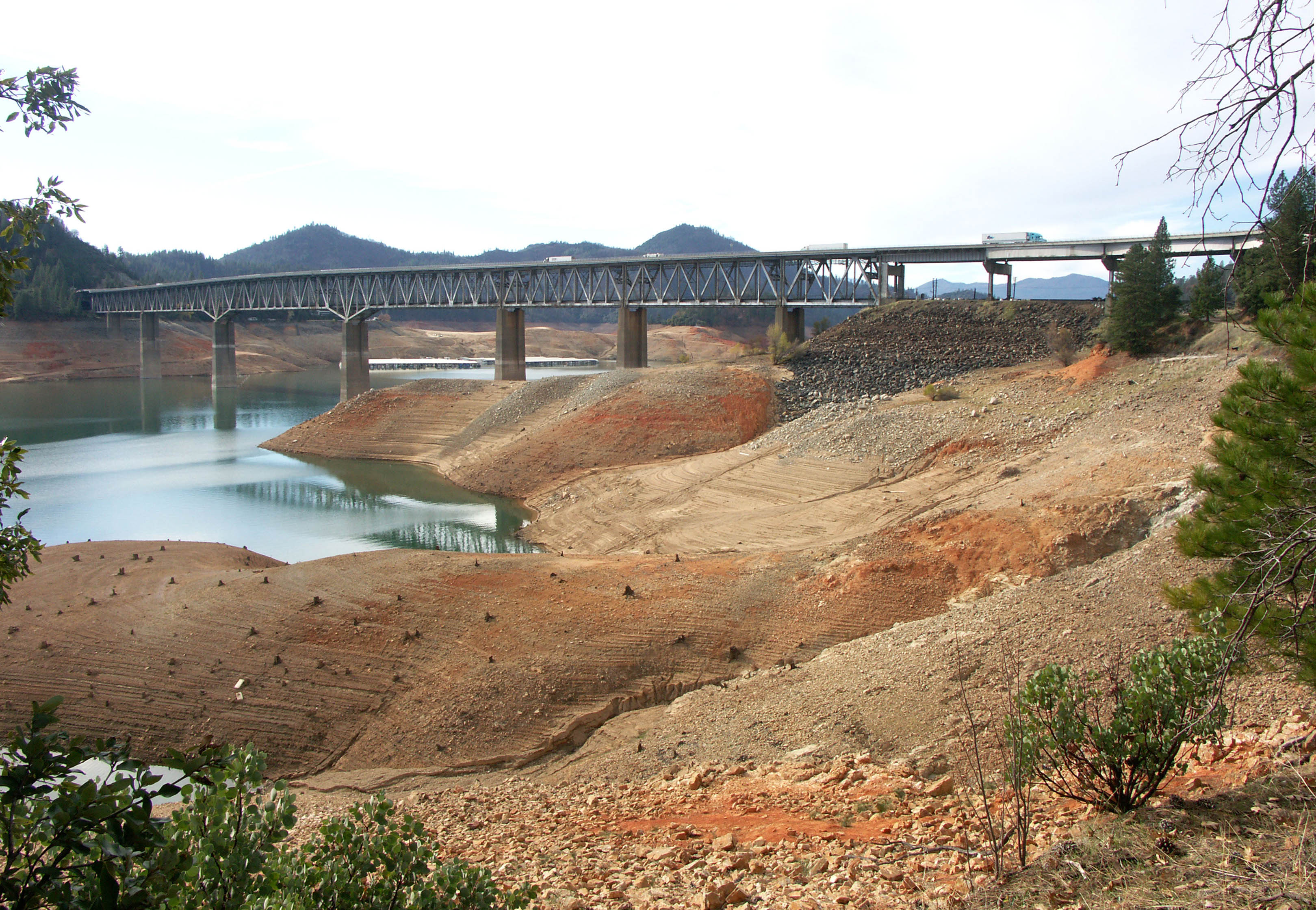
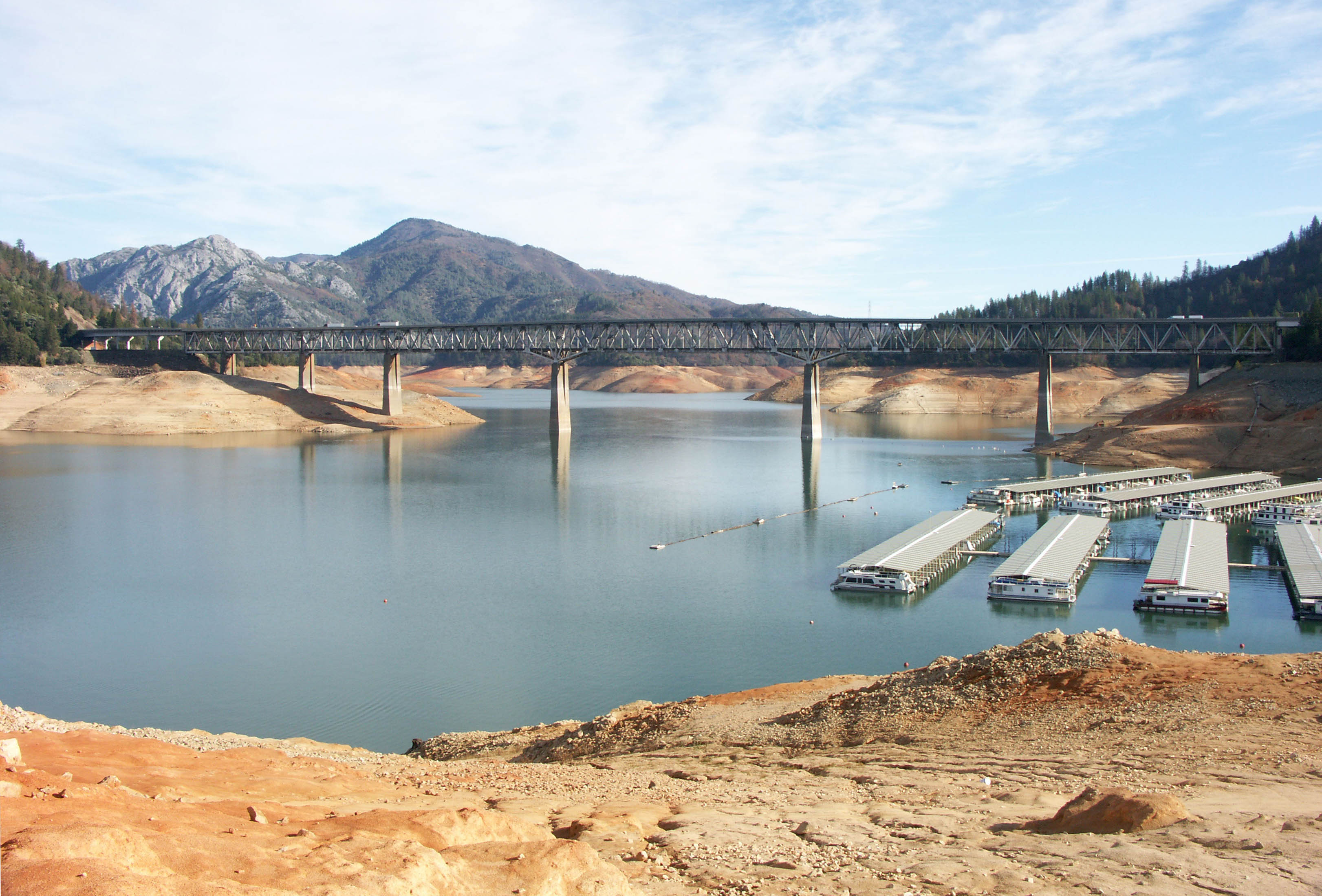
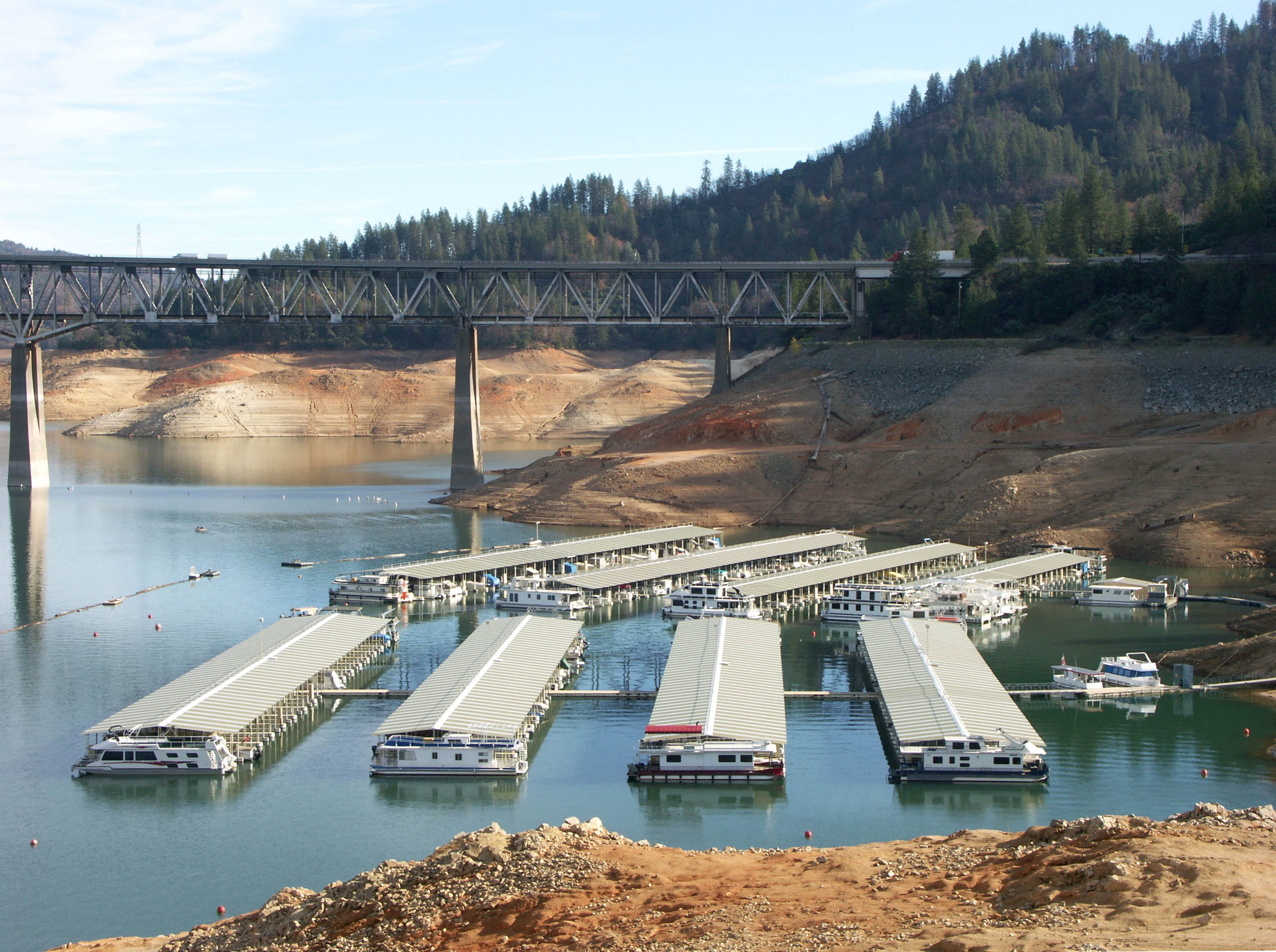
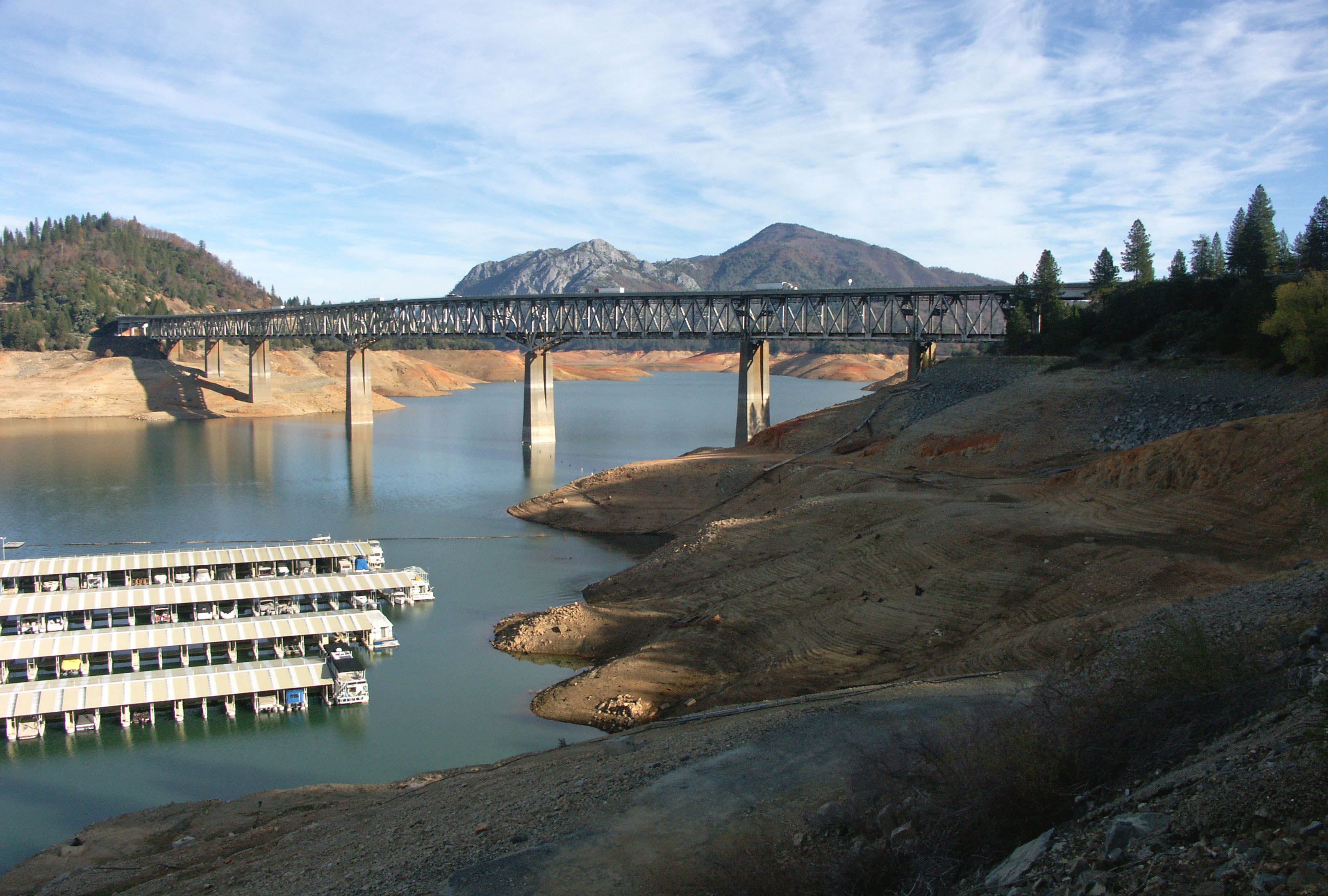
Despite nearly 70 years of service, discussion is now underway to build an entirely new road bridge next to the current one. The extra weight and wear and tear of a dual use structure has taken its toll on the bridge and the best solution is to leave the original bridge for rail use only. The problem in creating a new I-5 crossing is how to construct piers under the deep waters of Lake Shasta. A long span cable stayed or suspension bridge will probably be the only choice. Right now a replacement bridge is under construction for the I-5 Antler bridge crossing at the north end of Lake Shasta where it crosses the Sacramento River. Like the 1942-era Antler deck truss bridge, the new multi-span concrete beam crossing will be 200 feet (61 mtrs) above the original Sacramento River level. If you visit the region, be sure to check out the classic 1926 concrete arches over Doney, Charlie and Dog Creeks as well as the 4 other high trestles over Lake Shasta and two lower ones north of the lake over the Sacramento River. If you are lucky and the region is going through a drought, many of these normally submerged bridges become entirely visible. All of these structures may need replacing someday if proposals are approved to raise the height of Shasta Dam. A height extension of more than 20 feet (6 mtrs) would require the entire replacement of the current Pit River bridge since the bottom members would be too low to be protected from submersion in the lake. A higher Shasta dam would also require modifications of the rail line elsewhere along the lake as well as the replacement of the aforementioned bridges over Doney and Charlie creeks.
The Lake Shasta railroad relocation is one of several large U.S. rail line reconstruction projects that were undertaken in the 1940s, 50s and 60s from dam construction. In Montana, the Libby Dam and the resulting 90-mile Lake Koocanusa required the rerouting of the Great Northern railway through the 7 mile (11 km) Flathead tunnel. This new passage beneath Elk Mountain was completed in 1968. The dam was inaugurated in 1975 and also resulted in the construction of Montana’s highest road bridge 292 feet (89 mtrs) above the old Kootenai River level.
In 1950, Kentucky’s 101-mile long Cumberland Lake was formed from the Wolf Creek dam. A new crossing of the Cumberland River required the construction of a new, double line railroad bridge 270 feet (82 mtr) high - 110 feet (36 mtr) higher than the original bridge from 1880.
Perhaps the largest railroad realignment occurred in the early 1960s during the creation of Lake Oroville in central California when the Union Pacific railroad had to build several tunnels and two large bridges to skirt the massive West Branch arm of the lake before reentering the Feather River canyon at the north end of the North Fork. The 450 foot (137 mtr) high rail and road bridge across the West Branch of the Feather River is the second highest of its type in North America after the Pit River bridge. The lake is also home to the Bidwell Bar and Enterprise road bridges - two of North America’s highest reservoir crossings.
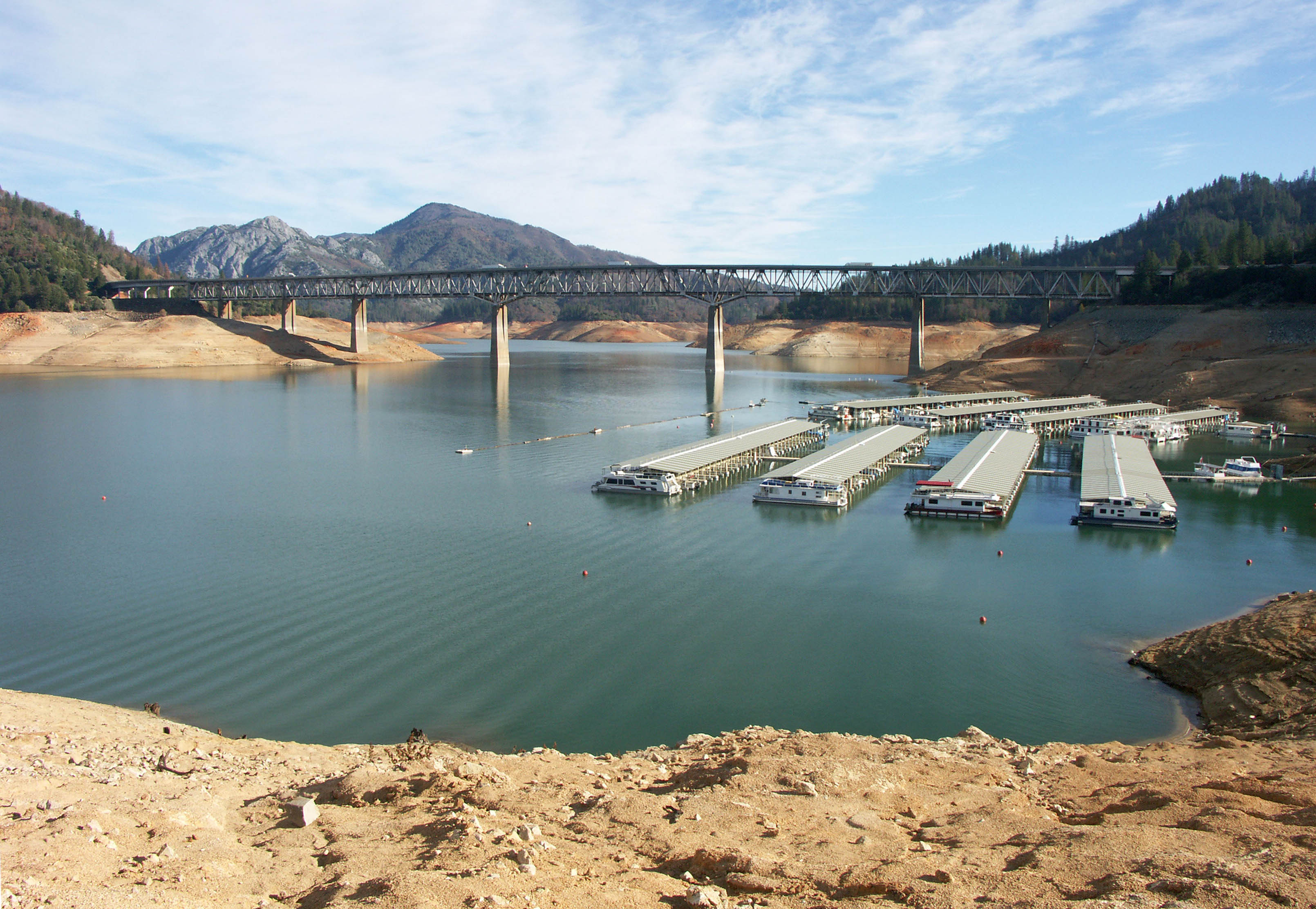
In this late 2008 view, a drought left Shasta Lake more than 150 feet (46 meters) below the normal full pool level of 1,065 feet (325 meters). Image by Eric Sakowski / HighestBridges.com
Image by Eric Sakowski / HighestBridges.com
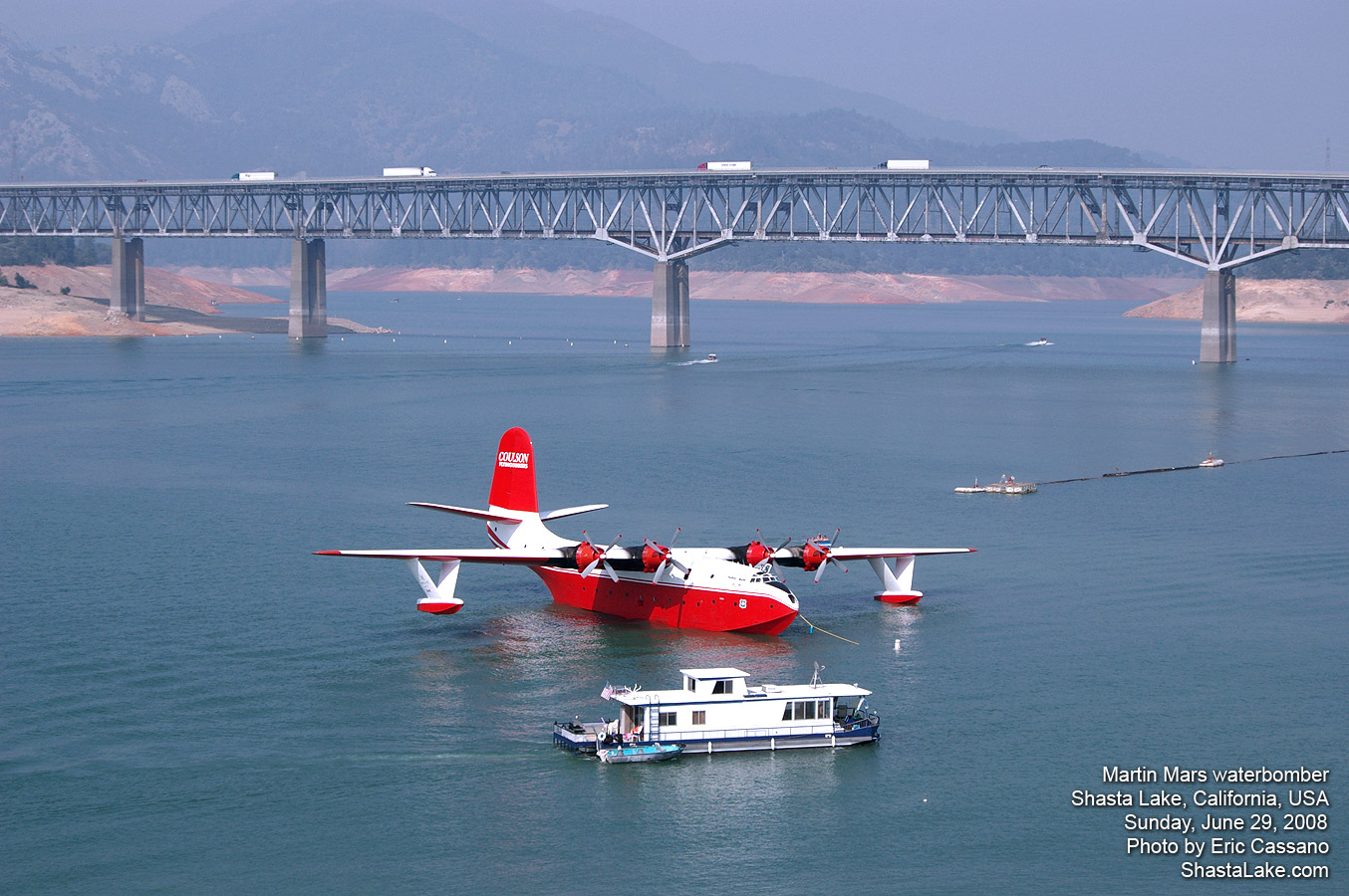
Image by Eric Cassano.
Image by Eric Sakowski / HighestBridges.com
Image by Eric Sakowski / HighestBridges.com
Image by Eric Sakowski / HighestBridges.com
Pit River Bridge image from California Highways and Public Works magazine.
Pit River Bridge image from California Highways and Public Works magazine.
Pit River Bridge image from California Highways and Public Works magazine.
Pit River Bridge image from California Highways and Public Works magazine.
Pit River Bridge image from California Highways and Public Works magazine.
Pit River Bridge image from California Highways and Public Works magazine.
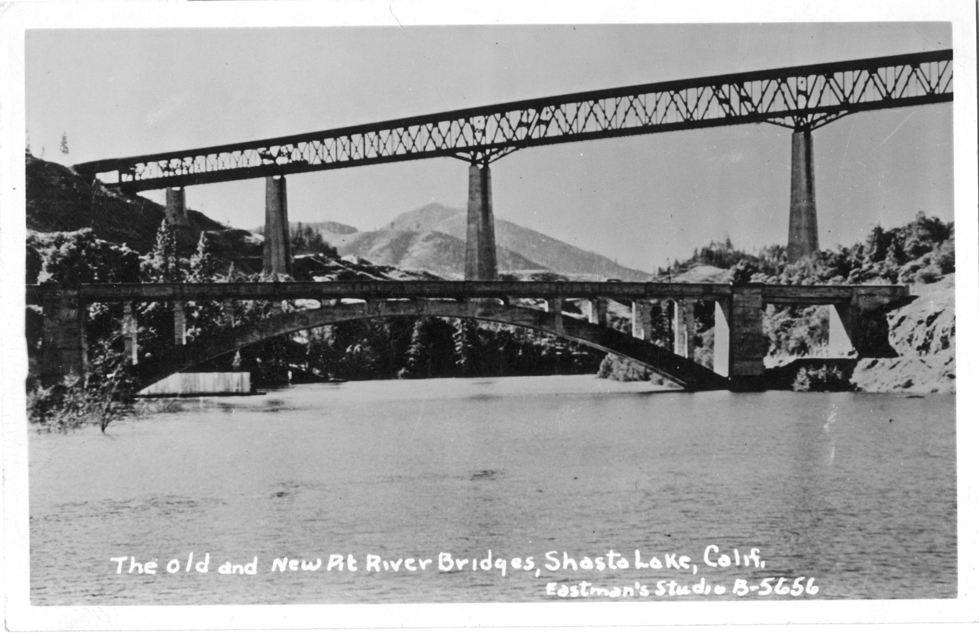
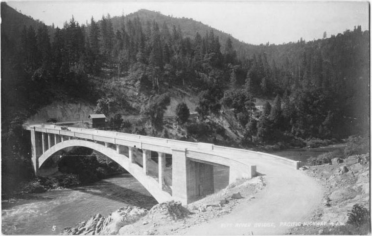
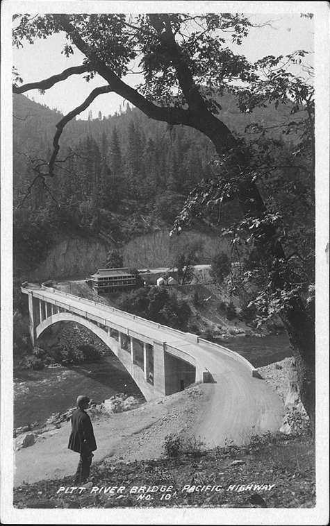
Pit River Bridge postcard showing the 1920s era bridge beginning to be submerged under the lake. The concrete arch still exists under 400 feet (122 meters) of water.
Pit River Bridge postcard.
Pit River Bridge image from California Highways and Public Works magazine.
Pit River Bridge image from California Highways and Public Works magazine.
Pit River arch bridge postcard.
Pit River arch bridge postcard.
Image by Eric Sakowski / HighestBridges.com
Image by Eric Sakowski / HighestBridges.com
Image by Eric Sakowski / HighestBridges.com
Image by Eric Sakowski / HighestBridges.com
Image by Eric Sakowski / HighestBridges.com
Image by Eric Sakowski / HighestBridges.com
Image by Eric Sakowski / HighestBridges.com
Image by Eric Sakowski / HighestBridges.com
Image by Eric Sakowski / HighestBridges.com
Image by Eric Sakowski / HighestBridges.com
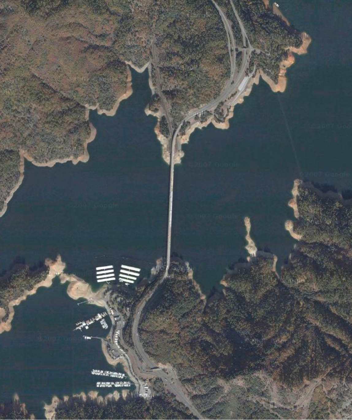
Pit River Bridge satellite image.
